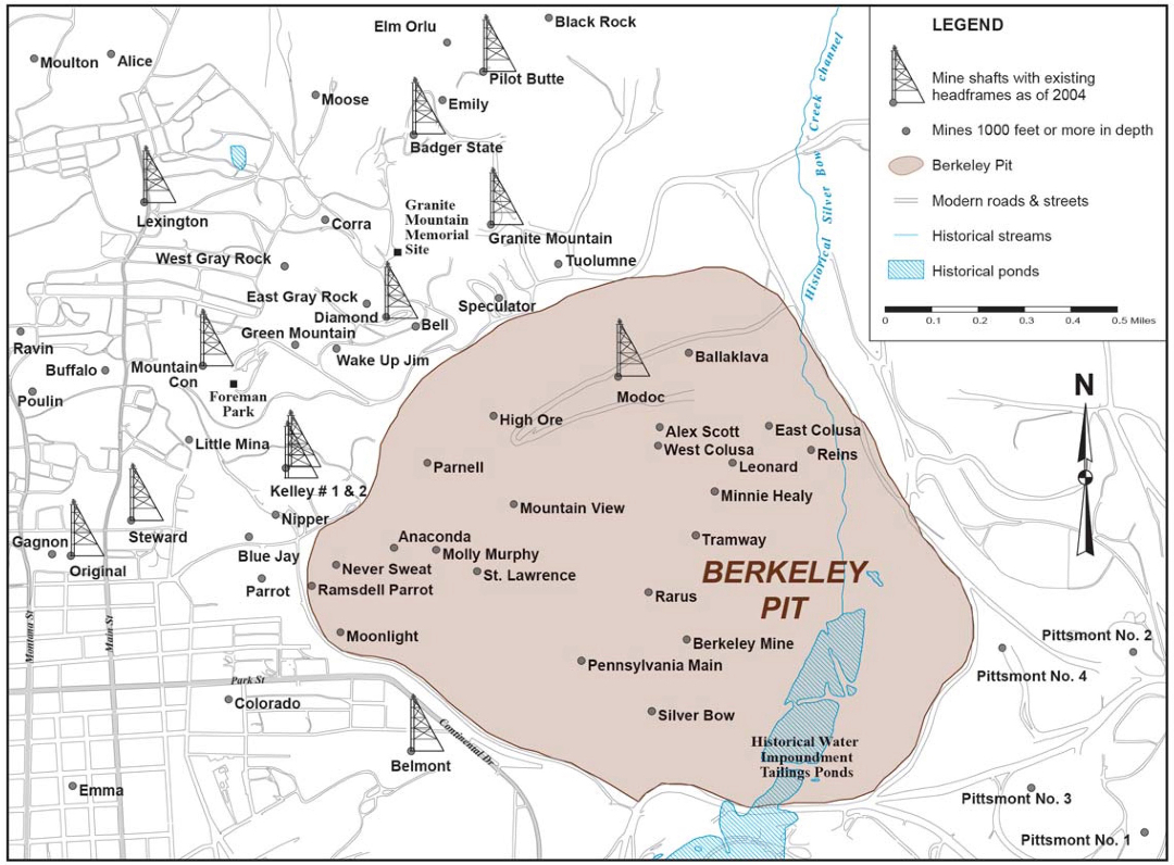
The map also shows locations of many of the prominent mine shafts, including surviving headframes, which once operated in the Butte mining district. Two wood headframes still stand on the north face of the Pit and are labeled here, the Parnell (mistakenly missing the headframe symbol) and the Modoc. MR’s Continental Pit is just beyond the right edge of the map. | Source: Duaime and McGrath, Butte Montanan: The Berkeley Pit, Changes in Water Quality and Water Sampling Methods, 1982-2017, Bulletin 138 (Butte: Montana Bureau of Mines and Geology, 2019), 12. Download Original File
Source
Duaime and McGrath, Butte Montanan: The Berkeley Pit, Changes in Water Quality and Water Sampling Methods, 1982-2017, Bulletin 138 (Butte: Montana Bureau of Mines and Geology, 2019), 12.
"Map showing the perimeter of the Berkeley Pit superimposed on a topographical street-grid of Butte. " appears in: Open-Pit Mining and Block-Caving