Story of Butte Logo
StoriesToursMap
Search Menu
Advanced Story Search ▸
Sitewide Search ▸
  • Home
  • Stories
  • Tours
  • Map
  • About
View a Random Story
App Store Google Play

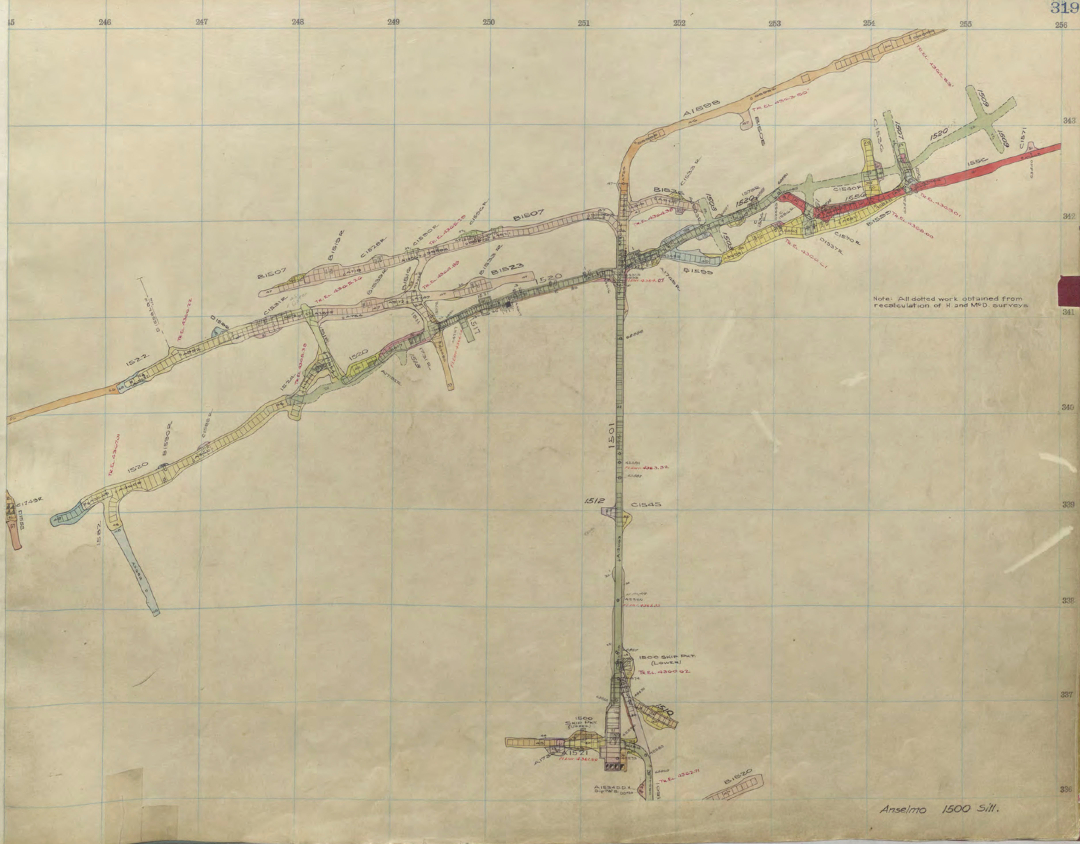
Map of Anselmo mine

ID: 5708 | This file appears in: Mine Surveying, Mine Maps, and Mine Models
The map of the Anselmo mine's 1500 level, from the Anaconda Company's stope books, shows the shaft at the bottom, with a northward crosscut extending from it and drifts branching east and west, following the vein rather than running due east and west.
Download Original File
"Map of Anselmo mine" appears in: Mine Surveying, Mine Maps, and Mine Models
Advanced Story Search ▸
Sitewide Search ▸
App Store Google Play
  • Home
  • Stories
  • Tours
  • Map
  • About
View a Random Story
© 2026 Butte Citizens for Preservation and Revitalization
Powered by Omeka + Curatescape